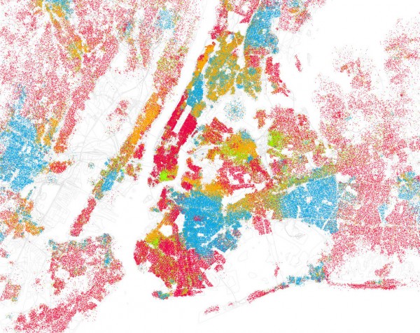
“I travel the world, and I’m happy to say that America is still the great melting pot – maybe a chunky stew rather than a melting pot at this point, but you know what I mean.” – Philip Glass
“Astounded” by the ethnic schisms of Bill Rankin’s Chicago Boundaries, data whiz Eric Fischer produced similar maps for other American cities. Above, we see the racial enclaves of New York – twenty five people to the dot, with Caucasians colored red, African Americans blue, Hispanics orange, and Asians green. Apparently, in the spectrum of food-to-integration metaphors, NYC is a tossed salad.
See maps of all forty cities – including the fine cultural blends of Los Angeles, stark Eight Mile divide of Detroit, and east-west segregation of Washington, D.C. – in the Race and ethnicity set on Eric’s flickr.
